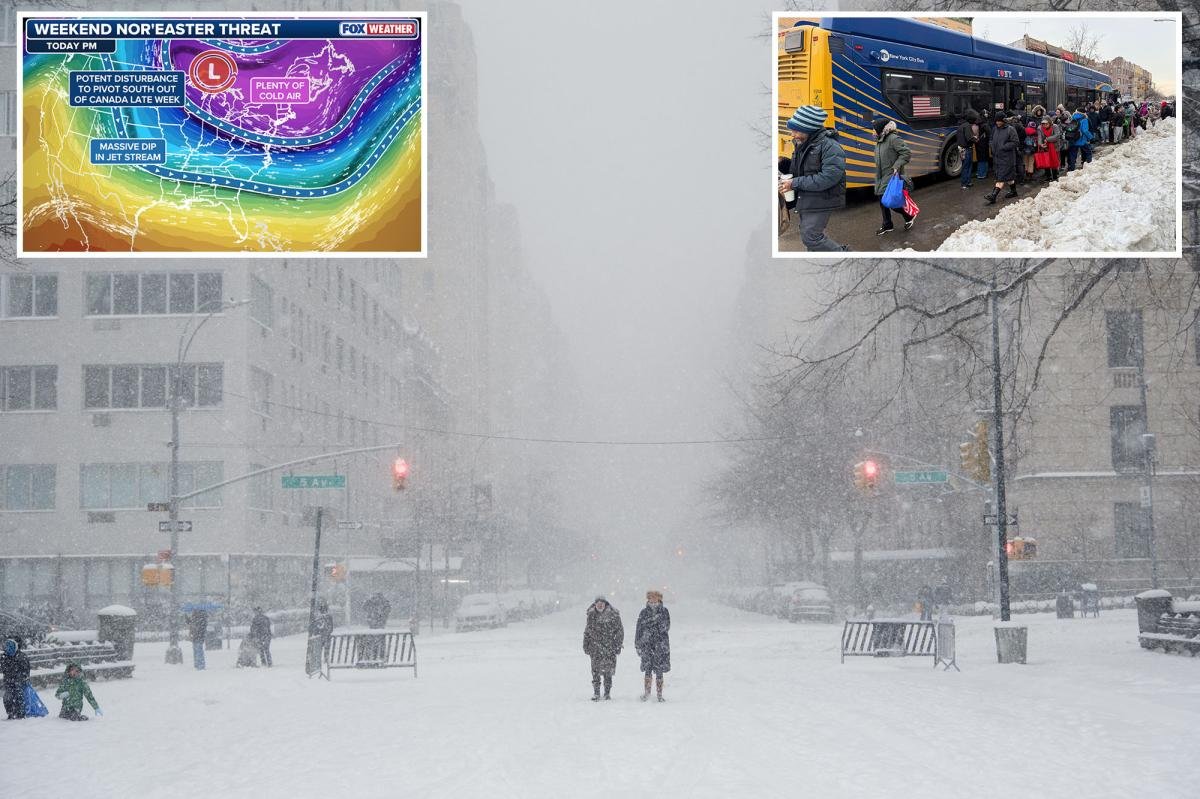
A life-threatening bomb cyclone is barreling towards the Northeast — threatening to slam New York City with even more snow and a record-breaking stretch of subfreezing temperatures.
The powerful storm is expected to swirl into the city Saturday night or early Sunday, dumping up to 3 inches of snow in the already-buried Big Apple.
“Prepare for the worst, and hope for the best,” AccuWeather Senior Meteorologist Tom Kines said Thursday.
“This is a rapidly intensifying storm. It will gather its strength and flex its muscles as it gets out over the ocean,” he said, adding the city will likely be socked by strong winds.
The storm, which is expected to blow out by Sunday night, comes as New Yorkers shiver through what’s likely to be the longest stretch of subfreezing temperatures in eight years.
New York City is forecast to see 12 consecutive days with high temps below freezing — the most since a 14-day stretch in January 2018, according to AccuWeather.
The longest stretch of subfreezing temperatures in the city’s history was 16 days in February 1961 — and it’s “not out of the question” that record gets shattered next week, according to AccuWeather Senior Director of Forecasting Operations Dan DePodwin.
Meanwhile, the Big Apple is still digging out from under roughly a foot of snow that fell as Winter Storm Fern struck between last Sunday and Monday.
“You run out of places to put the snow — that’s a major problem,” Kines said, adding it could cause dangerous driving conditions. “Some municipalities have started carting the snow away; you can only push it so many places when you’re plowing.”
It’s also possible, Kines said, that the storm only passes through the edge of the New York City, bringing less than an inch to the area.
Coastal parts of the Northeast including Cape Cod and Martha’s Vineyard, Massachusetts, are expected to be among the hardest hit areas in the Northeast — with rough six inches of snowfall and near-hurricane-level winds of up to 60 mph, Kines said.
Southeast New England, including parts of Massachusetts, Connecticut and Rhode Island, are in the storm’s bull’s-eye and expected to be most ravaged by the storm.
A bomb cyclone is a weather pattern, also known as a bombogenesis, that can quickly build up to deadly power as pressure drops — generally causing extreme wind and blizzard conditions.
The bomb cyclone is likely to hit the East Coast from South Carolina to Maine, with similar snowfalls of between 3 inches and a foot throughout, forecasters said.
Boston is expected to get between 3 and 6 inches of snow, while Philadelphia and Washington, DC, will likely see between 1 and 3 inches, according to AccuWeather.
Read the full article here